Welcome to
Norwest Surveying Services, Inc.
Specializing in.....
- Specializing in....
Lot Surveys
Parcel Surveys - Farm Surveys
Subdivision Design And Platting
Easement Surveys
Plats Of Vacation
Plats Of Annexation
Topographic Surveys
Section Corner Recovery
Geodetic Control Surveys
Corridor Route Surveys
Digital Terrain Modeling, and more....
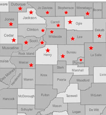
SERVING THE FOLLOWING COUNTIES:
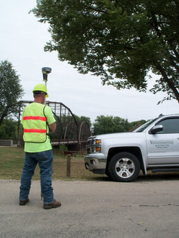
All your land surveying needs met in one office
Whether you're looking for boundary surveying, topographic surveying - including ALTA mapping, or construction staking, we can handle all your surveying needs. You'll get a precise, quality survey delivered quickly to you.
With over 40 years of experience and the best in modern equipment, our highly skilled, professional staff will promptly produce a thoroughly researched, accurately measured, well-managed, and precisely mapped survey for you.
The staff of Norwest Surveying Services, Inc. appreciates the opportunity to partner with you on your next project.